Posts

Showing posts from August, 2016

Adventures in QGIS continued
Image
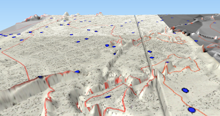
I'll do some how to guides on my experiments in QGIS with historical maps soon, but here's an aide memoire of the tutorials I've used: Creating a heat map: http://www.qgistutorials.com/en/docs/creating_heatmaps.html Creating a contour map: http://www.qgistutorials.com/en/docs/working_with_terrain.html And to show that I'm just messing around and not doing this systematically, here's my failed experiment to warp geo-referenced maps onto a DEM (elevation) layer: Apparently north Manchester has a mountain range according to this...

digital mapping experiments in QGIS

Image
I've been messing around with QGIS and old maps of Manchester. My approach at the moment is 'layer as many maps as I can find' and 'add as many different databases as I can' on the map and see what happens. I'll add some contextual and analytical information in another post. Here's a link to a simple map of Manchester (click on the expander on top right to layer a tile of Green's 1794 map on it), and the addresses of United Englishmen layered on it: http://protesthistory.org.uk/mcr1794trial.html There's a plugin in QGIS called QGIS2threejs which makes it easy to make elevations and buildings in 3D. So here's my slightly strange attempt to make Murray's Mills in Ancoats, together with a pub and some terraces, into 3D: Murray's Mills, Ancoats, in 3D Another plugin allows you to draw cartograms. Here's a gif comparing a straight map of Manchester police districts, coloured according to their population density in 183...